Sunday, April 28, 2024


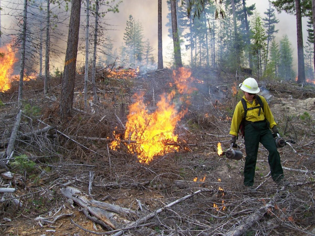
WENATCHEE — Following a successful year of prescribed burning in 2023, when over 10,000 acres of fuels were underburned or pile burned across the Okanogan-Wenatchee National Forest, spring prescribed burning operations will begin across the forest as soon as weather and fuel moisture conditions allow. Forest Service crews plan to use prescribed fire across approximately 9,951 acres on the Okanogan-Wenatchee National Forest this spring.
“Prescribed fire and thinning activities could start as early as the first week in March,” said Acting Deputy Fire and Fuels Staff Officer Andrew Hall. “Due to the mild winter and recent warmer temperatures, we will be able to gain access to our spring prescribed fire units earlier this year.”
The forest has been increasing the use of prescribed fire over the past several years, thanks largely to investments made in the Central Washington Initiative through the Bipartisan Infrastructure Law and Inflation Reduction Act. The Central Washington Initiative is part of the agency’s Wildfire Crisis Strategy to reduce the threat of wildfire to communities.
Information on Prescribed Fire Activity
For real-time prescribed fire maps and updates check the forest website, forest social media sites, or listen to the day/week of burn recorded voicemail message:
Smoke Readiness
People can expect to see and smell some smoke during burning operations. Although we manage prescribed fire to minimize smoke impacts, it is important that smoke-sensitive individuals plan ahead and be prepared. Also, use caution when traveling through areas where prescribed burning is occurring as visibility may be reduced due to smoke. For more information on smoke and public health, please visit wasmoke.blogspot.com or airnow.gov/fires.
Locations of Planned Burning
Managed burning operations, consisting of mainly underburning projects with some hand pile units, are planned on national forest lands in the following counties.
Okanogan County: (725 acres on the Methow Valley Ranger District)
Chelan County: (6,039 underburn acres on the Chelan, Entiat, and Wenatchee River Ranger Districts)
About Prescribed Fire
Prescribed burns help restore healthy and resilient forests by reducing the quantity of burnable fuels that would potentially feed wildfires These burns also help recycle nutrients back into the soil, promote growth of fire adapted and native vegetation, better protect nearby communities, and help reduce the risk and intensity of future wildfires.
The right conditions for prescribed fire include correct temperature, wind, fuel moisture, and ventilation for smoke. When these criteria are met, firefighters implement, monitor, and patrol each burn to ensure it meets forest health and public safety objectives while following air quality standards. All Okanogan-Wenatchee N.F. prescribed burns are weather and prescription dependent and fire specialists will cease burning if objectives are not being met.
Prescribed burns do not occur when burn bans are in effect. If a prescribed burn has begun, and a burn ban is determined, burning operations will cease as soon as possible.


Comments
No comments on this item Please log in to comment by clicking here